In the past, some of you have heard me talk about the terrible state of the road that connects Quibdó, the capital of El Chocó with the rest of the country. Okay, there are two—the other goes more southerly, towards Pereira, with a turnoff to southern El Chocó. The road to Pereira has always—in the short time I’ve been visiting—been in much better condition.
But the road to Medellín is really more important. Medellín is the major city that the people of El Chocó, and certainly of Quibdó, relate to. Although correctly referred to as “the highway,” the people here call it, more accurately, “la trocha”—a path cut through the forest.
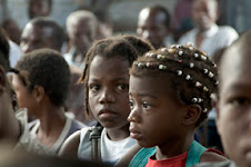
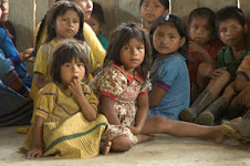
There is a lot of local lore about the road. It was constructed in the 1930s, and several communities and landmarks along the road are known by the construction camps that were erected where the communities are today. This I have visited “El 7,” “El 12,” “El 16,” “El 18,” “El 20,” and “El 21”—the last three being active Embera-Katio communities that hug the road. These places have real names, but hardly anyone could tell you what they are. And of course, there are other communities in the “zona de la carretera,”—indigenous communities like Toldas, Consuelo, Sabaleta, and deep into the forest quite a few more. As you approach El Carmen de Atrato, further ea and in the foothills of the Andes, the communities are more “paisa”—people of mixed ancestry (the term relates to the special mestizo culture of the “eje cafetero,” the coffee-growing area of the lower mountains). And as you approach Quibdó, especially once you get to the town of Tutunendo, the communities are much more Afro-Colombian (and wetter—the single rainiest village on the planet is near Tutunendo.
The fact that the main artery connecting Quibdó to the rest of the country has been in such terrible shape is the result of several factors. For one, it has never been paved (although here lies an important story—below). Also, the rains here are so constant, and often so heavy, that landslides onto the road, or cutting away bits of the road, are common.

Further, the main traffic is heavy trucks, that bring in almost everything that is sold in Quibdó (with the exception of local bananas and plátanos, some small-scale agricultural products, and fish, which all come in from the river. And the trucks leave carrying away loads of tropical hardwoods—the rain forest is being stripped away, and not that slowly.

Last year, some equipment was sent by the government to level the road, and it made a huge difference. Before, the trip from Quibdó to El Carmen—some 105 or 110 kilometers (about 65 or 68 miles)—would take, in a good car, eight or nine hours if there were no delays! Last year that was cut in half or more—but this year, the rains and the heavy trucks had done their work, and things are getting pretty bad again (I haven’t gotten as high as El Carmen yet on this trip, so I don’t know how long it will take now).
At times, things get bad enough on the trocha that Quibdó is essentially cut off from ground traffic—I was here once when there were six separate landslides, and for a week or more, no freight vehicles got through.
The truth is, the condition of the main road—no, the road—linking Quibdó, a departmental capital, with Medellín and from there most of the country is shameful, as well as being a symptom of much of the social and political problems of this country and this region. When I started coming here, seven years ago, there was a big billboard erected in the middle of this route, showing a big picture of the modern high-speed highway that was being built there (I have always regretted that I didn’t get a picture of that billboard). But that was it—no actual work, no paving, no nothin’.

My friends who are locals here explain that on paper that road has been paved several times—each time, the project is approved, the budget is approved and allocated, money is sent for materials and construction, and the money is spent. The only thing missing is the actual paving, which somehow never happens.
But on a recent trip up the trocha, I saw a clear indication that this time seems to be different; there is real work being done between Quibdó and Tutunendo. This is a happy change. Though people expect the project to take a few years, they are hopeful that it will really happen and make a difference in their lives.


But those who fear that in this way something of the culture of El Chocó will be lost needn't worry--except for the main streets, in Quibdó nothing has changed: in the barrios the streets are hardly straightened out, and much less paved.
En el pasado, algun@s de Uds. me han escuchado hablar del estado terrible del camino que une Quibdó, la capital de El Chocó, con el resto del país. Bien, hay dos—el otro va más bien al sur, hacía Pereira, con un desvío para la parte sureña del Chocó. La vía hacía Pereira siempre ha sido—en el tiempo corto que he estado visitando—en condición mucho mejor.
Pero la vía hacía Medellín en realidad es más importante. Medellín es la ciudad importante que más incidencia tiene en las vidas de la gente de El Chocó, y por cierto de Quibdó. Aunque se llama correctamente “la carretera,” la gente de acá la llama, muy acertado, “la trocha.” [¿necesita explicación?]
Hay muchos cuentos locales sobre este camino. Fue construido en los años 30, y varios comunidades e hitos por el largo de la vía son conocidos por los campamentos de construcción que fueron establecidos donde hoy en día se encuentran estas comunidades. Así, he visitado “El 7,” “El 12,” “El 16,” “El 18,” “El 20,” and “El 21”—las últimas tres siendo comunidades activas embera-katio en las orillas o muy cercas a la vía. Estos lugares tienen nombres reales, pero no hay casi nadie en las comunidades que te podrían decir que son. Y por supuesto, hay otras comunidades en “la zona de la carretera” (o simplemente “en la carretera”)—comunidades indígenas como Toldas, Consuelo, Sabaleta, y selva adentro hay muchas más. Al acercarte a El Carmen de Atrato, más al este y en las faldas de los Andes, las comunidades son meas “paisa,”—gente de herencia mixta (el término hace referencia a la cultura mestiza especial del “eje cafetero,” la zona de cultivo de café de las montañas más bajas). Y al acercarte a Quibdó, sobre todo una vez que llegas al pueblo de Tutunendo, las comunidades son más afro-colombianas (y más mojadas—el pueblo que meas lluvia recibe de cualquier pueblo del planeta queda cerca de Tutunendo).
El hecho que la artería principal que une Quibdó al resto del país ha sido en semejante condición terrible es resultado de varios factores. Uno es que jamás ha sido pavimentado (aunque acá yace una historia importante—abajo). Otro son las lluvias, que son tan constantes, y muchas veces tan fuertes, que derrumbes que caen sobre el camino o que se llevan pedazos del camino, son comunes.
Además, el tráfico principal es carros de carga pesados, que traen casi todo que se vende en Quibdó (menos bananos y plátanos locales, unos productos agrícolas en pequeña escala, y pescado, todos de ellos llegan a través del río. Y los carros salen llevando cargas de madera dura tropical—la selva húmeda se está arrasando, y no a paso tan lento.
El año pasado, unas maquinas fueron mandadas por el gobierno a nivelar el camino, y la diferencia fue grande. Antes, el viaje de Quibdó a El Carmen—unos 105 o 110 kilómetros—demoraría, en un carro bueno, entre ¡ocho y nueve horas si no había trabas! El año pasado eso fue reducido por la mitad—pero este año, la lluvias y los carros pesados habían hecho sus labores, y la cosa está volviendo mala otra vez (no he llegado tan alto que El Carmen, pues no sé cuanto de demoraría ahora).
A veces, la situación llega a ser tan mala en la trocha que Quibdó queda esencialmente aislada de tráfico terrestre—una vez estuve acá cuando había seis derrumbes distintos, o por una semana o más, ningún carro de cargo llegó.
La verdad es que el estado de el camino principal—no, el camino—que une Quibdó, una capital departamental, con Medellín, y desde allá la mayor parte del país, es una vergüenza, además de ser síntoma de muchos de los problemas sociales y políticos de este país y esta región. Cuando empecé a venir acá, hace siete años, había una valla grande en medio de este trecho que exponía una imagen grande de la autopista moderna que se construía allá (siempre he lamentado no haber sacado una foto de esa valla). Pero esa era todo—ninguna obra real, ningún pavimento, nada!.
Mis amig@s que son locales acá explican que en los documentos ese camino ha sido pavimentado varias veces—cada vez el proyecto ha sido aprobado, el presupuesto aprobado y sacado, el dinero ha sido despachado para materiales y construcción, y ese dinero ha sido gastado. El único que ha faltado ha sido el pavimentar, que de alguna manera jamás se realiza.
Pero durante un viaje reciente por la trocha, vi una indicación que esta vez parece ser distinta; hay obra real entre Quibdo y Tutunendo. Este es un cambio bueno. Aunque la gente cree que el proyecto va a demorar por unos años, está esperanzada por la posibilidad de que suceda de hecho y produzca mejoras en sus vidas.
Pero los que teman que por eso se va a perder algo de la cultura chocoana no deben preocuparse--salvo por las calles principales, en Quibdó no hay cambio: en los barrios, las calles ni se arreglan, y mucho menos se pavimentan.