

A trip downriver
Finally, thinking it might not happen during this long visit, I got a chance to take a trip downriver and make quick visits to four traditional river communities. This is really important to me, and I’ll start by describing the spell the river has over me, and the first visit. I hope within a sort time to post entries about the rest of the trip.
The Río Atrato
One of the musical groups I like here, Tanguí Chirimía, has a song about the “Majestic Atrato,” and I think that just about nails it. This is not the Cuyahoga River, folks (of course, on the other hand, it isn’t the Mississippi either, but you know…). It’s not a very long river—a little over 700 km—but because of the rainy climate here (have I mentioned the rain?), the topography, and what I understand are more than 400 tributaries, many navigable, an awful lot of water flows through its course.
Once you get to Quibdó, it’s pretty broad—from here down, it probably ranges between about 150 and 400 meters across, with a number of channels that are narrower but more direct for travel. As it approaches the delta where it empties into the Gulf of Urabá, the main flow divides into several narrower channels.
Here in Quibdó, the river seems particularly alive. If there are a few days of heavy rain here and upstream, the river rises notably. After a few days without rain, it drops with equal drama. I’ve been told, but haven’t experienced this, that in the years when there’s a good “summer” (a dry season—usually starting in December and lasting a couple of months) the river really drops, and it’s something to see.
Below (before the Spanish text) are a couple of pictures of the settlement across the river from downtown Quibdó, called Bahía Solano, with the river high and low in normal fluctuations after a few days of rain or little rain.
Downstream, the changes are not so abrupt. There are important swamps that serve as buffers; when there’s little rain, water flows from them into the river, so it doesn’t drop so quickly, and when there’s a lot of rain, they absorb some of the extra water, so the river is also slower to rise.
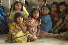
The Atrato is one of three main watersheds in El Chocó, and the only major river that flows north to empty into the Caribbean; the Río Baudó and the Río San Juan are more southerly and empty into the Pacific. My work has been in the area of the Atrato, particularly the Upper and Middle Atrato and some of its tributaries. It’s the area I know, and the river has a strong pull for me; I find it alive and truly majestic. Along its shores, and along its tributaries are traditional and newer communities of Afro-Colombian and Indigenous peoples. Communication and commerce for these communities is by water; the “champa” or dugout canoe, and the “canalete” or oar, are central images in the local cultures.
The river has been damaged by human activities: mining pollutes the streams and tributaries that feed it, poisoning the water and destroying fish populations, while also increasing the sedimentation that contributes to much more flooding than previously; lumbering produces erosion that also contributes to sedimentation; over fishing and pollution reduce populations of fish that have been a critical part of the human food supply and culture for centuries.
These changes are reflected in the words of the song by Tanguí Chirimía (named for Tanguí, a riverside village, a community that has recently been affected by the violence of the armed conflict; I expect to write about them soon). You can find the words to the song and an English translation here.
www.stevecagan.com/Choco/majestuosoatrato.html
Meanwhile, one problem I have as a photographer is to figure out how to take pictures from the boats—basically, at the level of the river—that give a sense of the scale of this wonderful river. Here are some, anyway... (after the Spanish text)


Un viaje río abajo
Al fin, cuando había llegado a pensar que no iba a pasar durante esta visita tan larga, se me presentó la posibilidad de viajar río abajo y hacer visitas rápidas a cuatro comunidades tradicionales ribereñas. Hacerlo me importa mucho, y voy a comenzar con una descripción del hechizo que tiene este río por mi, y la primera visita. Espero dentro de poco poner entradas sobre el resto del viaje
El río Atrato
Uno de los conjuntos de música que me caen bien acá, Tanguí Chirimía, tiene una canción sobre el “Majestuoso Atrato,” y creo que eso d en el blanco. Esto no es el río Cuyahoga, mi gente (por supuesto, al otro lado, tampoco es el Mississippi, pero ya saben…)No es un río muy largo—algo más de 700km—pero por el clima lluvioso acá (¿he mencionado la lluvia?), la topografía, y lo que tengo entendido son meas de 400 afluyentes, muchos navegables, es un río muy caudaloso.
Al llegar Quibdo, es bastante ancho—desde acá probablemente anda entre 150 y 400 metros de ancho, con una cantidad de brazos que son más angostos pero más derechos para viajar. Al acercar l delta donde desemboca en el Golfo de Urabá, el caudal principal se divide en varios brazos más angostos.
Aquí en Quibdo, el río parece particularmente vivo. Si hay unos cuantos días de lluvia dura acá y río arriba, el río crece notablemente. Después de unos días sin lluvia, baja con igual drama. Me han dicho, aunque no lo he experimentado, que en los años que tienen un buen verano (normalmente empieza en diciembre y dura un par de meses) el río baja de veras y es algo impresionante.
Arriba hay un par de fotos del caserío que queda en frente del centro de Quibdó que se llama Bahía Solano, con el río crecido y bajado en las fluctuaciones normales después de unos días de mucha o poca lluvia.
Río abajo, los cambios no son tan abruptos. Hay ciénagas importantes que sirven como represas; cuando hay poca lluvia, el agua fluye desde ellas hacia el río, de tal manera que no baja tan rápido; cuando hay mucha lluvia, absorben algo del agua extra, por eso el río tampoco crece muy rápido.
El Atrato es uno de las tres cuencas primarias en El Chocó, y el único río mayor que fluye al norte para desembocar en el Caribe; el río Baudó y el río San Juan están más al sur y desembocan en el Pacífico. El trabajo mío has sido en la región del Atrato, especialmente medio y Alto Atrato y algunos de sus afluyentes. Es l zona que conozco, y el río tiene mucha atracción para mi; lo encuentro vivo y de hecho majestuoso. Por sus orillas y sus afluyentes se encuentran comunidades tanto tradicionales como nuevas de pueblos afrocolombianas e indígenas. La comunicación y el comercio para estas comunidades son por agua; la “champa” o canoa, y el “canalete” o remo son imágenes centrales en las culturas locales.
El río ha sido dañado por actividades humanas: la minería contamina las quebradas y afluyentes que le alimentan, envenenando el agua y destruyendo poblaciones de peces, mientras también aumenta la sedimentación que contribuye a las inundaciones que son más frecuentes que antes; la tala de árboles para madera produce la erosión que también contribuye a la sedimentación; un pescar excesivo y contaminación desminuyen las poblaciones de los peces que han sido una parte crítica de la alimentación y cultura humanas por siglos.
Estos cambios se reflejan en la letra de una canción de Tanguí Chirimía (que lleva el nombre de Tanguí, un pueblo ribereño, una comunidad que últimamente ha sido afectado por la violencia del conflicto armado; espero escribir sobre ellos dentro de poco). Pueden encontrar la letra y una traducción acá.
Mientras tanto, un problema que tengo como fotógrafo es, ¿cómo sacar fotos desde el bote—básicamente al nivel del agua—que dan un sentido de la dimensión de este río maravilloso? De toda forma, aquí hay unas…


No comments:
Post a Comment